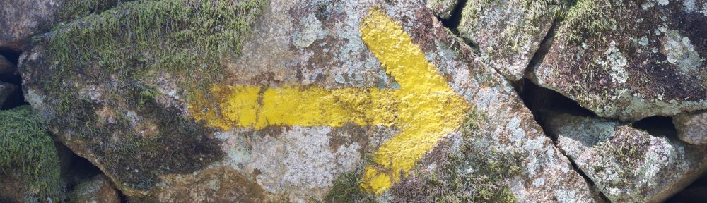
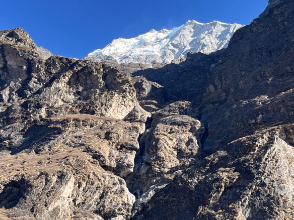
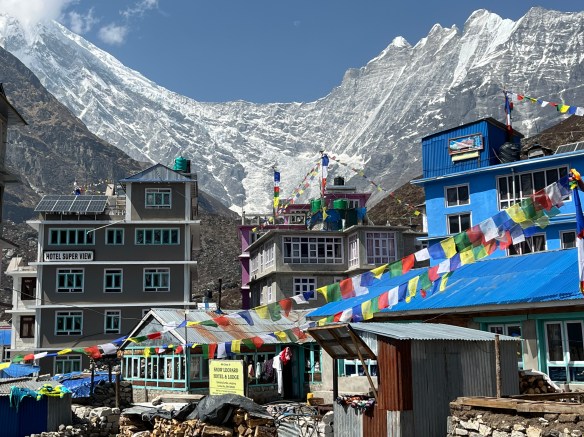
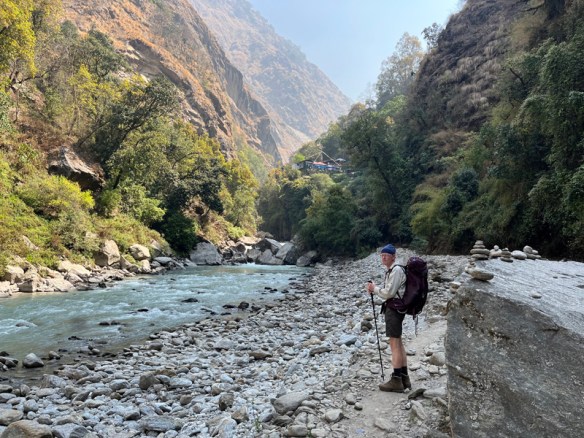
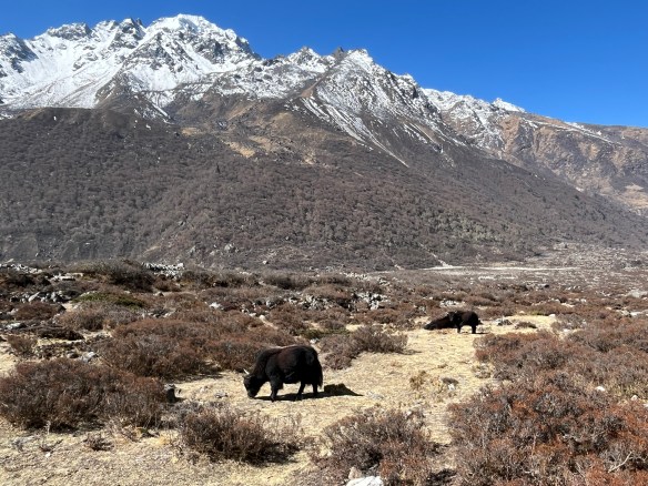
Langtang Valley, was the answer when people asked us where we wanted to go in Nepal. A trek in Langtang VaIley is a popular, fairly short hike if you take the bus to the startingpoint Syabru Bezi. We started not far from Kathmandu in the Helambu, a much less known area. From Tulo Syabru we walked to the valley. it is a route along the river that you walk back and forth. The last village is Kyanjin Gompa at an altitude of over 4000 meter.
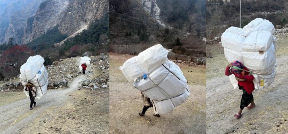
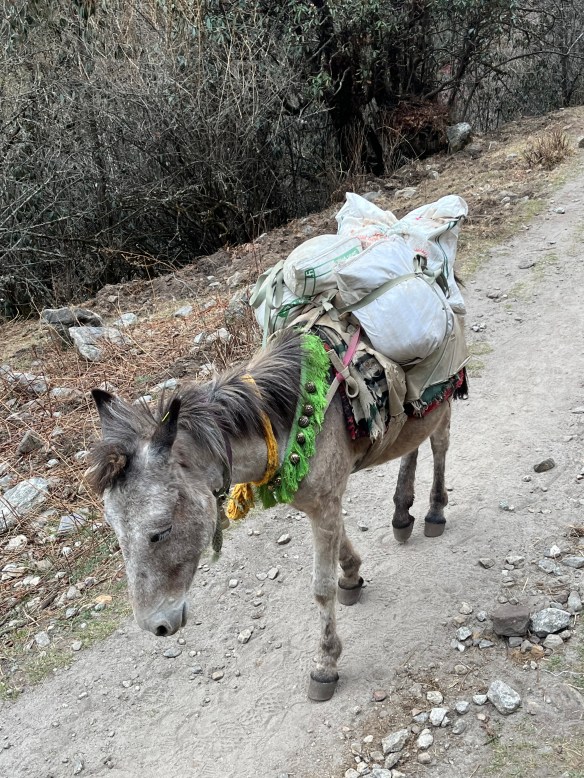
There is no road in the valley, only a path along the river. It means that everything that is needed is transported by porters or by horses.
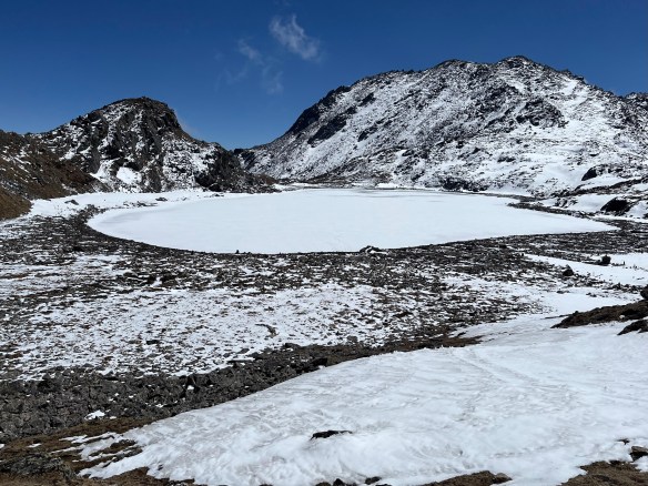
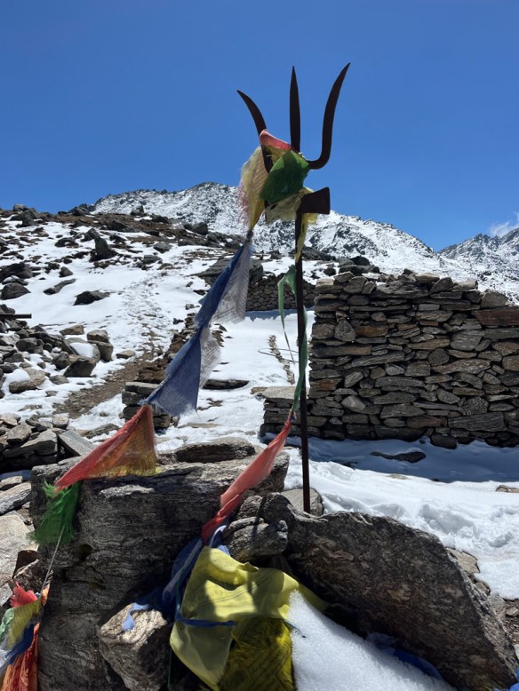
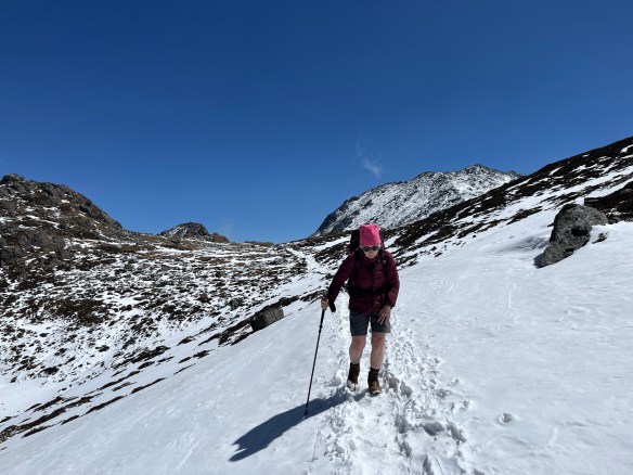
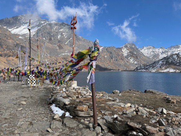
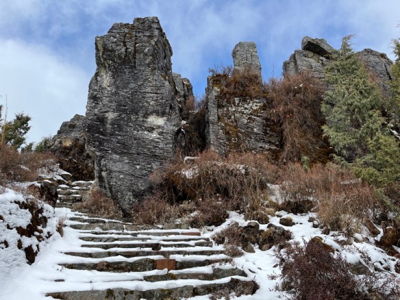
After a week of walking and gradually increasing ascent, the big challenge is the Suryakunda pass (altitude 4620 meters) to Gosaikunda. We have already passed the Thadepati pass (altitude 3650 meters). And that went smoothly. But the next day the altitude really became noticeable. We did not have altitude sickness, but our legs felt heavy. We therefore decided to stay in Phedi, in the lodge and make the crossing the next morning. We were the only guests there. The son, Chean, walked around and when we asked him, he was willing to help us with a backpack the next day, up to the highest point. The next day we left early. The landscape was bare, but beautiful. The pass could be seen from the start. It was tough, but beautiful. On the pass is the Trident of Shiva. Legend has it that the three holy lakes after the pass were made by Shiva by that Trident.
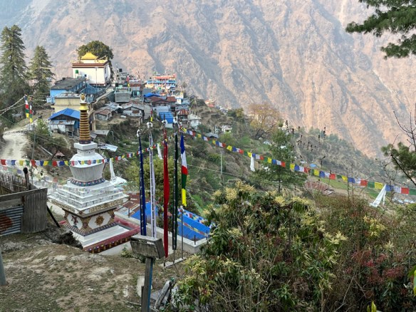
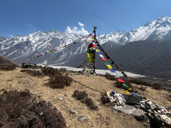
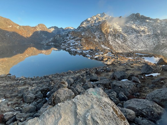
We rested on the pass. Chean descended again and we continued walking. The upper lake was frozen and still covered with snow. It was beautiful and so quiet. Only we were there. Footsteps were visible, and we followed them. Slowly down. We passed another lake and then there was the large holy Hindu lake. It is the place where many Hindu pilgrims go. We passed ceremonial places with many fluttering prayer flags. Gosaikunda is a collection of lodges on the lake. We chose a room. It was cold, but at 5 o’clock the wood stove was heated.
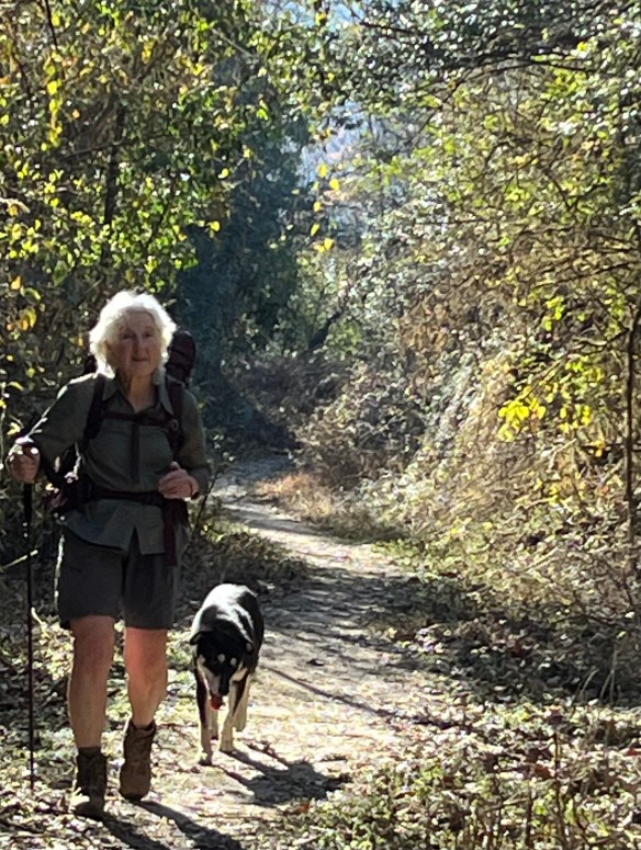
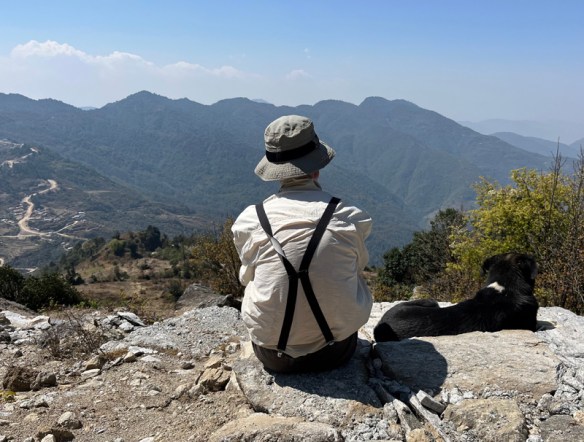
Throughout the Helambu, from the very first day, we had the company of a nice dog; it really became a friend
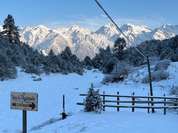
In Magingoth, still in the Helambu, we arrived quite early and we were in doubt whether to stay or continue to the pass and beyond. We walked a bit further, but when we saw the sky getting dark we turned back. And what luck. Not much later a heavy thunderstorm started and it started to snow.
The next morning the sun was shining, the snow was still there. it was magically beautiful.
Bilbao was the end point of our tour. And we enjoyed it there. The visit to the museum and the surroundings of the building was a great experience. Nice was also the Mercado de la Ribera, the large covered fresh market, where we ate pintxos with a glass of cold white wine. In the Casco Viejo, the old city district, we enjoyed a Menu del Dia.
You could see the Guggenheim Museum as the icon of Bilbao. The building has been standing on the Nervion river since 1997. The building is spectacular and has given Bilbao a vibrant image. The design is by Frank Gehri and cannot be compared to any building. The use of titanium was new. It is beautiful in the ever-changing light and that together with the shapes give the building an idea of waves. Louise Bourgeois’ giant spider stands on the square along the river. By Anish Kapoor there is the ‘Tall Tree & The Eye’: reflective spheres stacked on top of each other.
.
The Guggenheim Museum Bilbao is one of three Guggenheim Museums around the world alongside Peggy Guggenheim Collection in Venice and the Solomon R. Guggenheim Museum in New York. The museums belong to the Solomon R. Guggenheim Foundation in New York.
After our walk on the Chemin de Piemont to Lourdes, we traveled from there by train to the coast, to St. Jean de Luz. Via Hendaye we walked to Irun, to Spain. That is the start of the Camino del Norte. This is a well known Camino and there are more hikers. It was nice to see the ocean, although the route sometimes goes more inland. The Pyrenees are close by and this is noticeable in the height differences.
This is Basque Country and the names of the towns are difficult to remember; such as Etxebarria or Markina Xemein.
As in many parts of Europe, it was also very wet in the Midi-Pyrenees this year. We had many sunny days, but the recent heavy rain caused a lot of mud in the woods. That made the walks difficult.
What we didn’t really realize is that this region is so sparsely populated. It was not always easy to find a place to sleep or to eat. With the exception of a few hotels we slept mostly in Chambre d’Hôtes, were people also cooked for us. Remote places and we were always the only guests.
We slept in a Chambre d’Hôtes in a farm, run by Audry, the daughter of the family. We agreed to have breakfast at 8 o’clock in the morning. But when we got in the dining room the next morning, everything was still dark, there was no one to be seen. A car drove up and Audry got out with paper bags. She had driven to the bakery for us, about 18 km from there, the closest place to buy bread.
Further along the road we passed Capvern les Bains, an old place with thermal baths. The town consisted of hotels and a few cafes, but everything was empty and abandoned. Our hotel was located just outside the village and was fine. Fortunately, they wanted to cook for us in the evening, and again we were the only guests.
There were no catering facilities along the way and there was actually no way to find a place to rest. We passed through villages where even the Marie (the town hall) was only open for a few houres a week. There were houses, but the shutters and the gates were closed.
There were just a few towns where we slept and were we ate in a restaurant among other people in the evening. But no other hikers.
Still, it surprised us, because the surroundings are beautiful. It is mountainous, many flowers bloom and there are regular views of the snow-capped peaks of the Pyrenees. We saw many Red-Kites soaring through the air. And once we saw a flock of Vultures flying from the moutains to the meadows.
We traveled by train to the medieval town of Carcassonne in the Midi-Pyrenees and from there we went walking via the Chemin de Piemont, which largely coincides with the Gr78. It is a Camino to Santiago de Compostela, wich was used by Italians in ancient times. The route runs along the Pyrenees and via a few old towns, through Lourdes and then on to Saint Jean-Pied-de-Port.
Carcassonne, Cabieure, Ambroisie, Mirepoix, Pamier, Montegut, Mas d’Azil, Saint Girons, Juzet-d’Izaut, Saint Bertrand-de-Comminges, Montrejeau, laBastide, Bagneres-de-Bigorre, Lourdes
We walked to Lourdes and took the train to the coast, to St. Jean-de-Luz. From there we walked to Spain and walked a few sections of the Camino del Norte to Bilbao.
Sri Lanka is an island south-east of India in the Indian Ocean. An island has coasts.
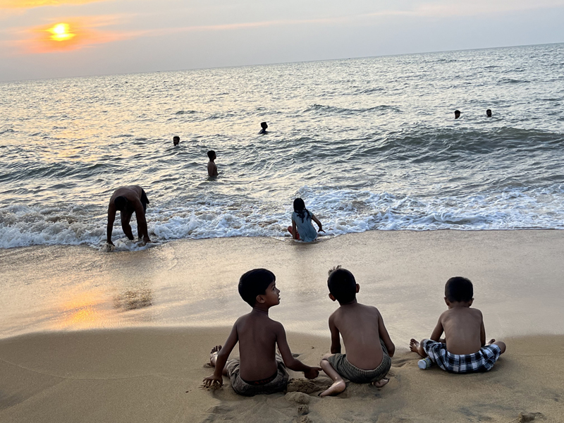
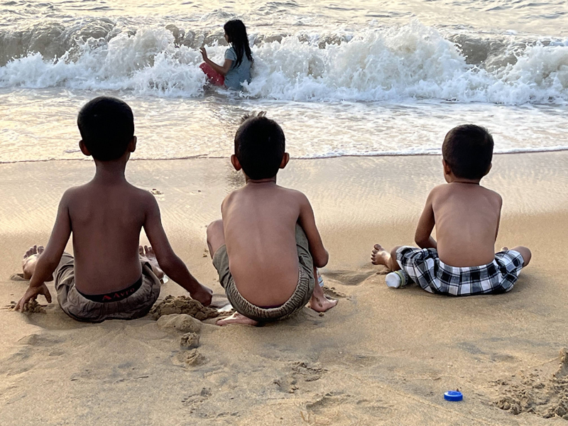
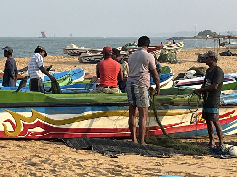
We started our trip in Negombo, near the airport. Here we could get used to the warm temperature and the time difference. In the morning, before breakfast, we took a walk along the beach. It was still relatively cool. At that time there were sportsmen and the fishermen preparing their boats.
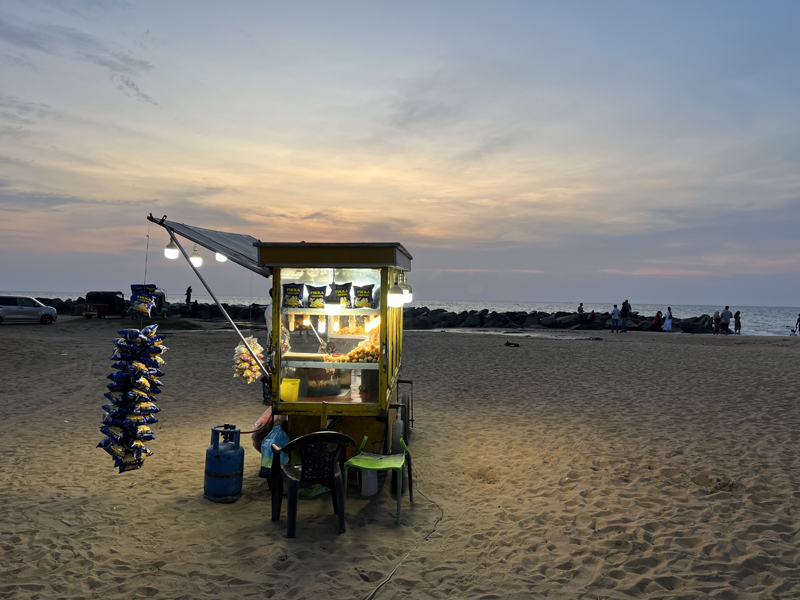
We also walked along the new boulevard in Colombo, the big city, at the end of the afternoon. Recreation time there too. Strolling, putting your feet in the water, eating a snack …
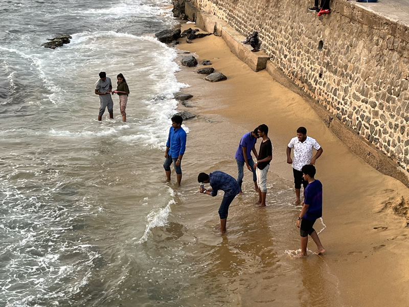
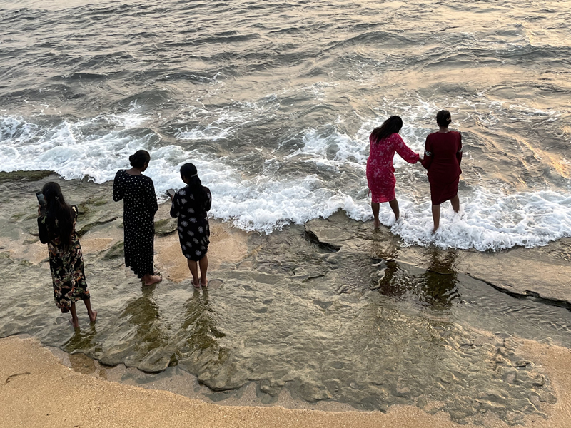
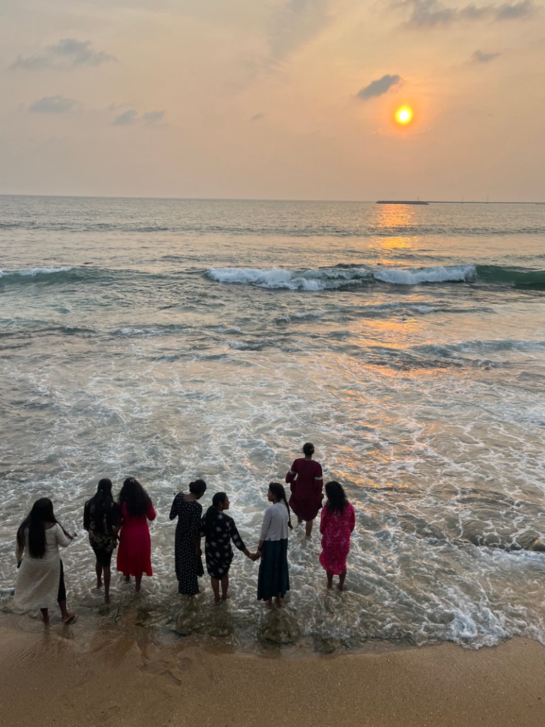
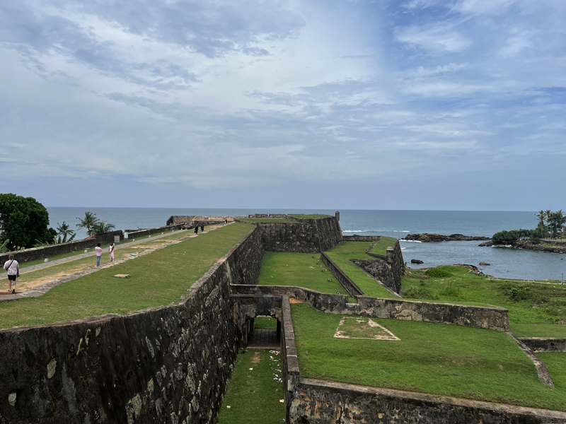
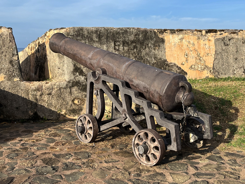
Galle is a fortified town on the south coast of the island and is now a Unesco world heritage site.
The Dutch VOC was very active in Asia and has also left its marks in Sri Lanka. The Portuguese built fortress here, but the Dutch overpowered the Galle Fort and took over the city. Galle Fort was an important spice trading port for the Dutch. They enlarged the stronghold after the conquest in 1640. They build a defensive wall, complete with bastions, powder magazines and cannons. And this is well preserved.
Some names, such as Utrecht Bastion, where the lighthouse is located, Zwart Bastion and Akersloot Bastion still remind us of the Netherlands.
Inside the fort there are white houses with red tiled roofs. There is still a Dutch church.
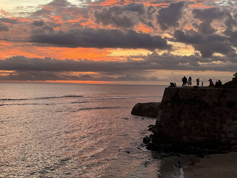
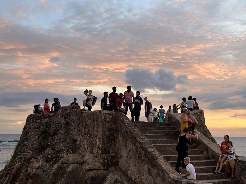
The rampart wall is a favourite place for both tourists and residents of Galle to enjoy the sunset.
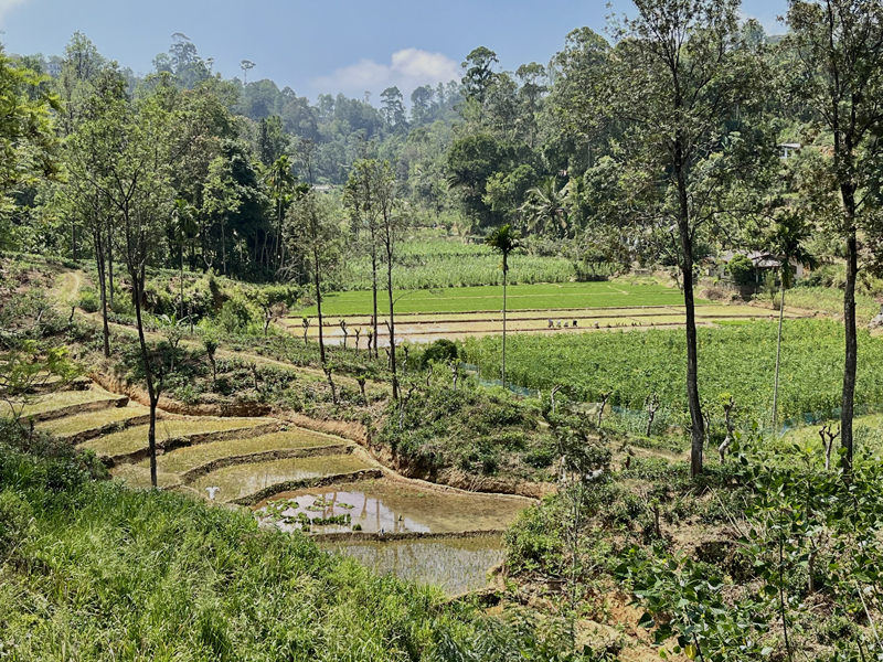
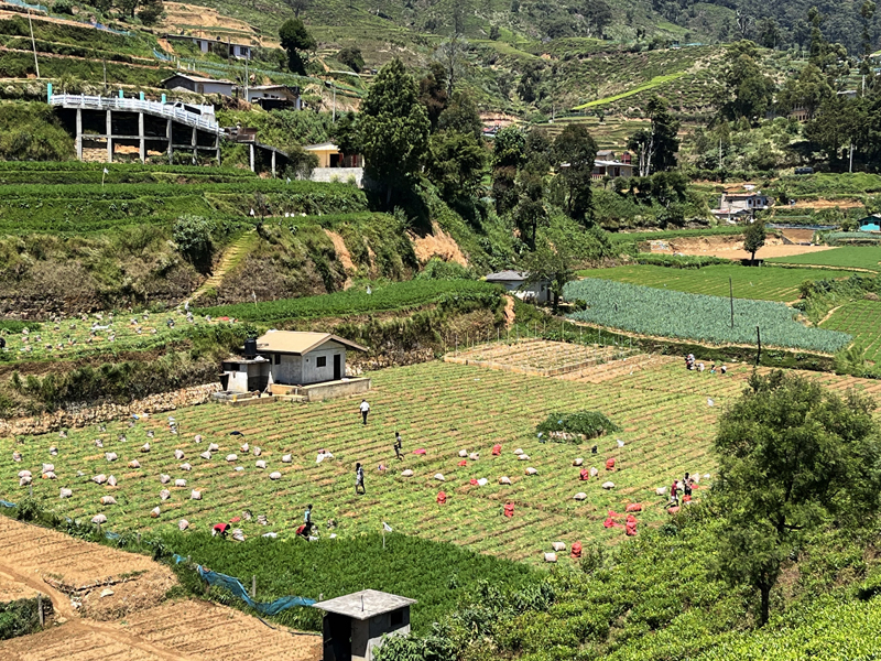
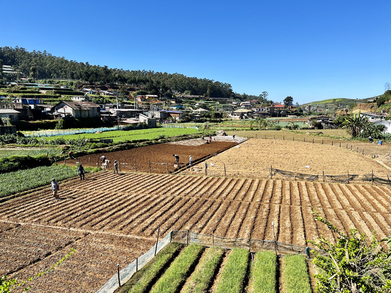
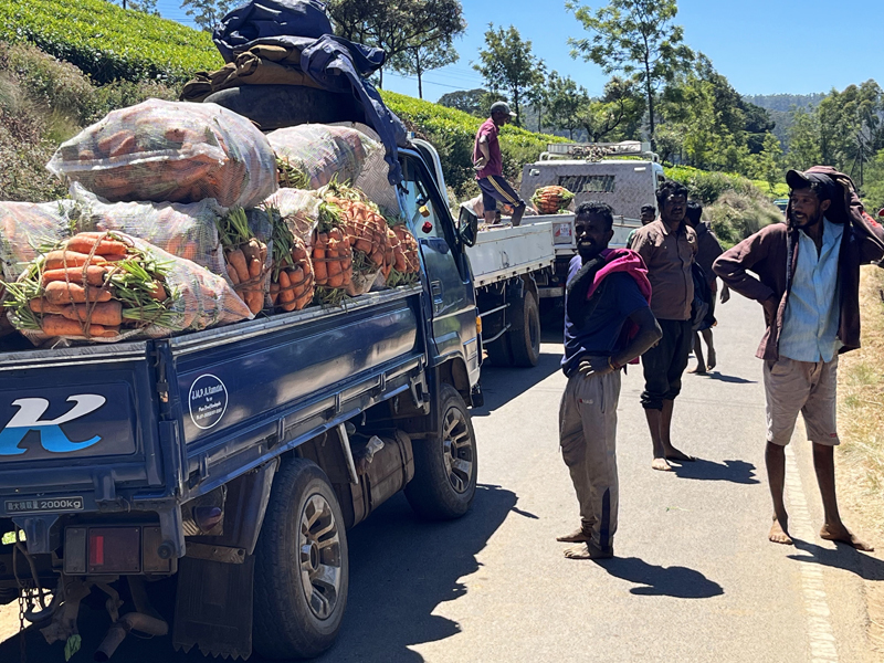
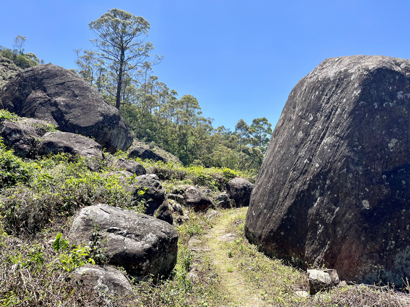
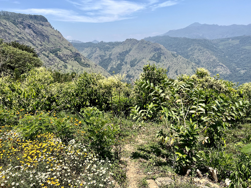
The Pekoe Trail runs through the mountain landscape in the central part of Sri Lanka; a 300 km long distance walk, divided into 22 stages. The trail shows the diversity of the region. The route runs through tea plantations, small villages, horticulture and forests.
We walked a few parts of the trail using the All Trails app.
For us it was a wonderful way to experience the local life of the country. People on the road, the tea pickers, the people in the horticultural areas and in the communities were very friendly. We didn’t meet many other hikers, perhaps because it is also warm in the mountains.
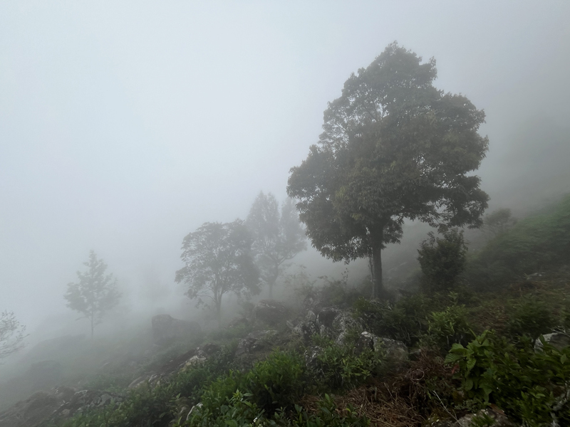
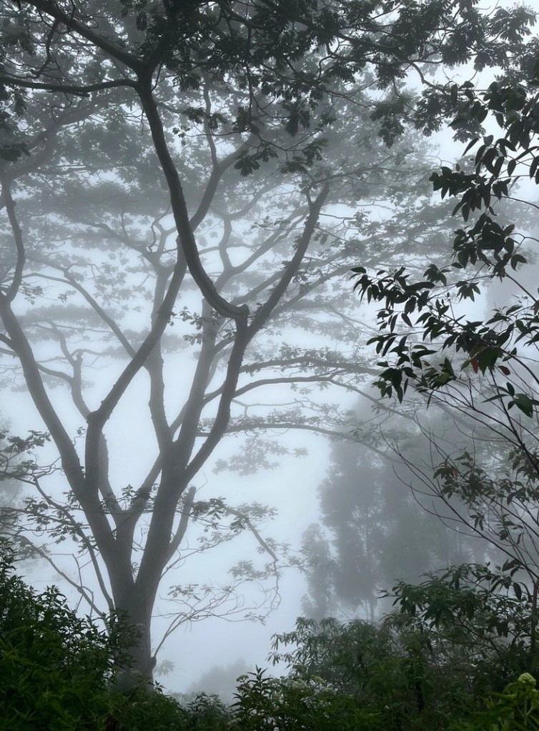
Our last walk was the longest and most spectacular. We walked from Ohiyo, a high station (1778m) , to Haputale. We started in the fog and walked along steep slopes. In the forest we climbed over fallen trees. The path is sometimes so narrow that we have difficulty finding it. The landscape is sometimes rugged and beautiful. The route also partly goes over the railway and even through a railway tunnel. It will also rain for the first time. There are no rest points. After 20 km there is the hotel, a shower and food.
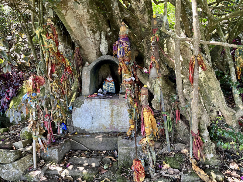
Along the way we came across Hindu shrines near enormous trees.
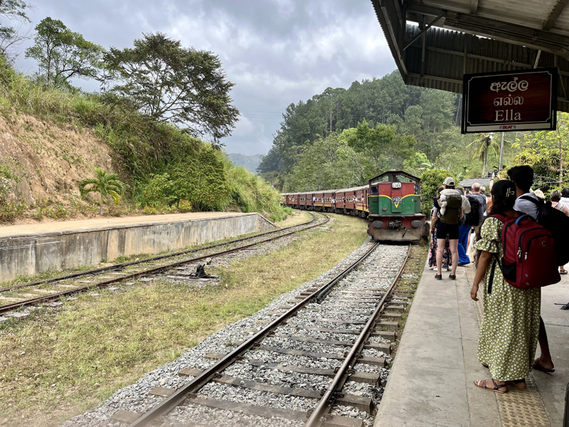
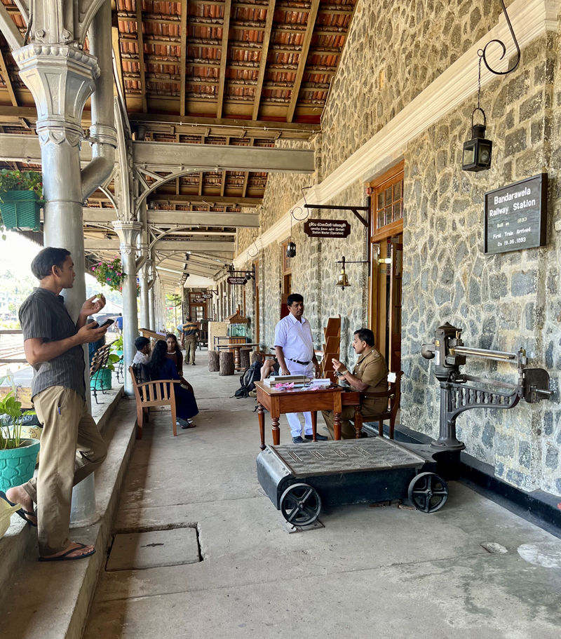
Tea and trains belong together. There are railways in Sri Lanka because of tea.
The English who were the tea producers in the 19th century built the railways to transport the tea from the mountains to the port of Colombo.
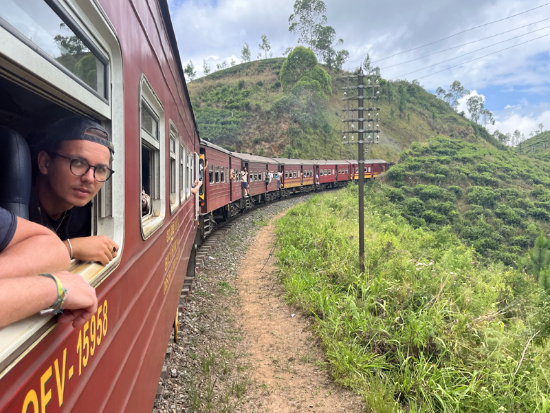
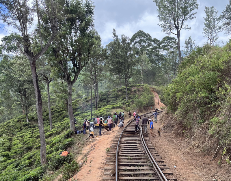
It is amazing how the routes were built in the high mountains. The Ohiyo station is located at an altitude of 1778m. There are many tunnels on the routes. From behind the open windows of the train you have a view of the slopes with tea plantations.
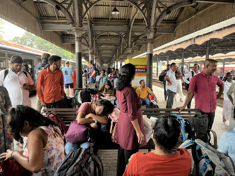
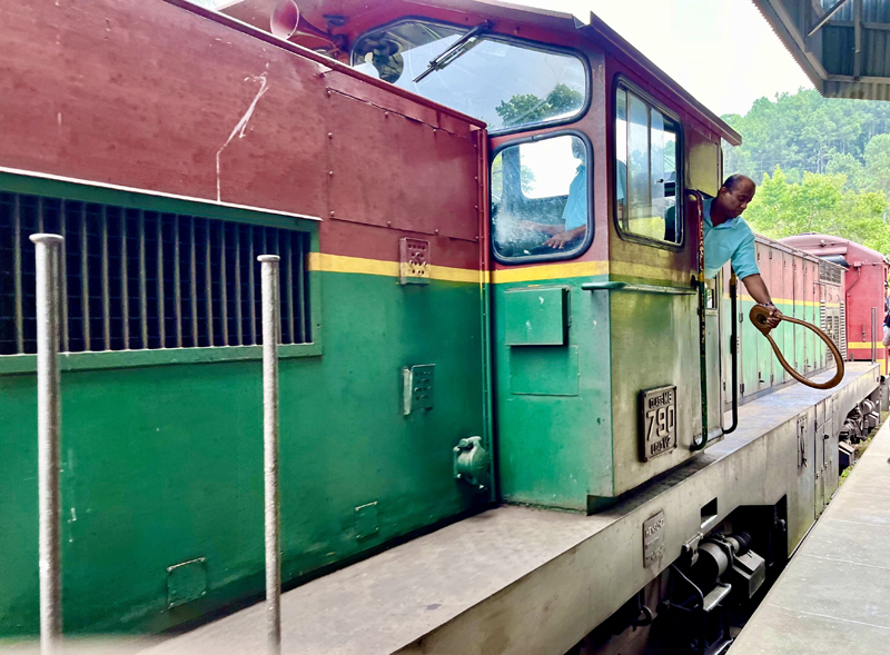
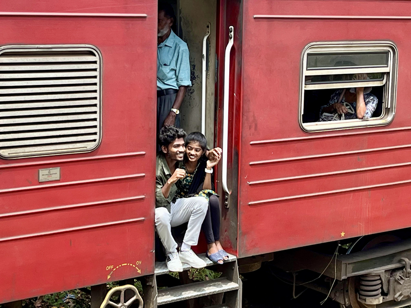
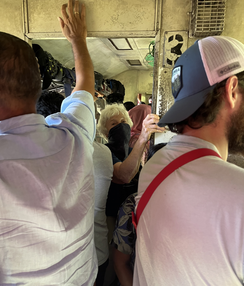
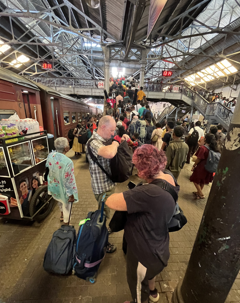
Traveling by train in Sri Lanka is a special experience. We took the train several times to our next destination. Fortunately, we travel with a backpack that is not too heavily packed. That makes traveling by train a lot easier.
Twice we had a reserved place. But on the other routes we just had to wait and see if we could sit. Sometimes the train was so full upon arrival at the platform that we thought we would no longer be able to get in. But with fitting and measuring….
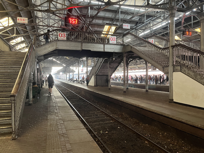
Several stations with cast iron pillars are special places. The trains are old now, but the station employees are looking great in green or bright white uniforms.
The train tracks are used by the locals as a walking path to get to the next town more directly.
Taking the train in Sri Lanka is an hype by tourists.